![](https://realitymaps.app/wp-content/themes/oceanwp-child-theme-master/touren/img/l_skitour_23712.jpg)
![](https://realitymaps.app/wp-content/themes/oceanwp-child-theme-master/touren/img/hochtour_blau.png)
La Varella und Faneshütte (Hüttenzustieg)
Dolomiten
Skitouren
leicht
![](/wp-content/themes/oceanwp-child-theme-master/touren/img/icons/tour-meta-ic-duration.png)
1:30 h
![](/wp-content/themes/oceanwp-child-theme-master/touren/img/icons/tour-meta-ic-ascent.png)
500 m
![](/wp-content/themes/oceanwp-child-theme-master/touren/img/icons/tour-meta-ic-descent.png)
0 m
![](/wp-content/themes/oceanwp-child-theme-master/touren/img/icons/tour-meta-ic-length.png)
7.0 km
Schwierigkeit
![](https://realitymaps.app/wp-content/themes/oceanwp-child-theme-master/touren/img/icons/scaleNone.png)
Ausdauer
![](https://realitymaps.app/wp-content/themes/oceanwp-child-theme-master/touren/img/icons/scaleNone.png)
Landschaft
![](https://realitymaps.app/wp-content/themes/oceanwp-child-theme-master/touren/img/icons/scaleNone.png)
Tourbeschreibung
Start:
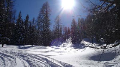
Diese Skitour beinhalten den Zustieg zur La Varella und Faneshütte ausgehend vom Rifugio Pederü. Dabei folgt man dem Sommerweg Taleinwärts leicht ansteigend zum Lago Piciodel und folgt dann dem Vigilbach hinauf zu zun Hütten.
Mehr Touren in der Region Dolomiten
-
Hochebenkofel, 2905m
Dolomiten | Skitouren | schwer
-
Dolomiten Etappe 3, 2913m
Dolomiten | Skitouren | schwer
-
Piccolo Vernel, 3098m
Dolomiten | Skitouren | schwer
-
Dolomiten Etappe 4, 2617m
Dolomiten | Skitouren | schwer
-
Dolomiten Etappe 2, 3152m
Dolomiten | Skitouren | mittel
-
Monte Cevedale, 3672m
Dolomiten | Skitouren | schwer
![OG Icon](https://www.realitymaps.app/wp-content/uploads/2020/01/og_icon.png)
Der Tourenplaner Pro
Tourenplanung 3.0 mit der Panorama Karte der Alpen
Deine Vorteile im Überblick:
![](https://www.realitymaps.app/wp-content/uploads/2020/01/icon_5000touren.png)
Über 5000 Touren, davon über 3000 von den Bergexperten des Bergverlag Rother
![](https://www.realitymaps.app/wp-content/uploads/2020/01/icon_sync.png)
Mit der App aufgezeichnete Touren speichern, laden und mit anderen Geräten synchronisieren
![](https://www.realitymaps.app/wp-content/uploads/2020/01/icon_gpx.png)
GPX-Tracks aus anderen Tourenportalen importieren
![](https://www.realitymaps.app/wp-content/uploads/2020/02/icon_drawer_routing.png)
Coming soon: Routen selbst zusammenstellen und planen
![](https://www.realitymaps.app/wp-content/uploads/2020/01/Tourenplaner_Dolomiten.png)
Wie erhalte ich Zugang zum Tourenplaner Pro?
Der Tourenplaner Pro ist nur mit einem App Abo nutzbar. Lade dir unsere 3D Outdoor Guides App aus dem Appstore oder Google Playstore und wähle in der App ein Abo deiner Wahl. Registriere dich dann in der App und verwende diesen Login für den Tourenplaner Pro, um alle Vorteile zu erhalten.