Ambri – Pian Mott – Fiesso
Tessin Nord
Wandern
mittel
5:30 h
1060 m
1100 m
13.9 km
Schwierigkeit
Ausdauer
Landschaft
Tourbeschreibung
Start: Ambri
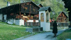
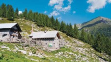
Von Ambri-Sopra, 980 m, an der Hauptstraße 1,5 km südöstlich des Bahnhofs in Höhe einer auffälligen Lagerhalle mit Runddach, 50 m auf asphaltierter Straße hoch zu einer Wegverzweigung (WW »Lago Tremorgio«). Dort geradeaus über eine kleine Brücke, dann auf schmalem, unbefestigtem Fahrweg bergwärts. In steilen Kehren durch Nadelwald hinauf zu den Wiesen von Gioett. Vorbei an den Hütten und einer Kapelle in weitem Bogen über die große Lichtung, bis wir auf den quer führenden Höhenweg »Sentiero alto Tremorgio« treffen, der ...
Dies ist eine Tour aus dem Rother Verlagsprogramm. Die vollständige Tourenbeschreibung steht nur mit einem App-Abo zur Verfügung.
Mit dem Abo werden zusätzlich alle Premium-Funktionen des Tourenplaner PRO freigeschaltet.


Mehr Touren in der Region Tessin Nord


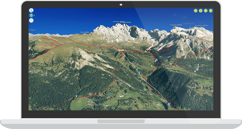
Der Tourenplaner Pro
Tourenplanung 3.0 mit der Panorama Karte der Alpen
Deine Vorteile im Überblick:
Über 5000 Touren, davon über 3000 von den Bergexperten des Bergverlag Rother
Mit der App aufgezeichnete Touren speichern, laden und mit anderen Geräten synchronisieren
GPX-Tracks aus anderen Tourenportalen importieren
Coming soon: Routen selbst zusammenstellen und planen
Wie erhalte ich Zugang zum Tourenplaner Pro?
Der Tourenplaner Pro ist nur mit einem App Abo nutzbar. Lade dir unsere 3D Outdoor Guides App aus dem Appstore oder Google Playstore und wähle in der App ein Abo deiner Wahl. Registriere dich dann in der App und verwende diesen Login für den Tourenplaner Pro, um alle Vorteile zu erhalten.