

Hiking
Gsponer Höhenweg
A tour by:
Rother Hiking Guide Upper Valais (Michael Waeber, Marianne Bauer)
- 18.4 km
- 05: 15 pm
- 800 m
- 296 m
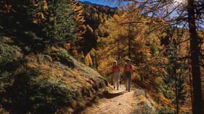
Following historical trails high above the Saas Valley: The Gspon High Trail is one of Valais's premier high-altitude trails. Always near the treeline, it offers consistently magnificent views of the opposite peaks of the Mischabel group and down into the Saas Valley. It also has a historical significance: In earlier times, the lower reaches of the Saas Valley were impassable. Therefore, the trade and pack animal routes between Valais and northern Italy led from Stalden up the mountain to Gspon and then along the high slope to Heimischgartu. Only from there could one descend back down to the valley floor at Saas-Balen/Saas-Grund – and then continue on to the Monte Moro Pass and Macugnaga. In Gspon, there is a chapel with a striking crucifix dating from 1694.
Starting point: Gspon, 1893 m, a small settlement high above Stalden, not accessible by car. Connected by cable car (LSSG) from Stalden via Staldenried (intermediate station) almost every half hour (www.staldenried.ch). Stalden, about 800 m; located above the confluence of the Visp valleys, old village center.